



(139,- Kc)
Pozadavky: Android 2.3.3 a vyssi
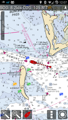
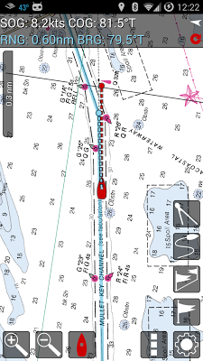
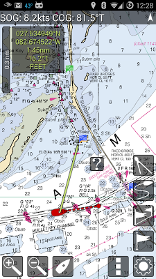
Popis: MX Mariner is a basic mobile marine navigator / chart plotter featuring quilted offline raster marine charts.
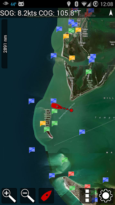
Raster marine charts published by NOAA (USA), LINZ (New Zealand) and Brazil Navy are available to install from within MX Mariner as free, downloadable regions. Once downloaded, each marine chart region is available for use offline. When online, a road map or satellite image map is alternatively available.
UK chart regions are available for the United Kingdom, Ireland and Channel Islands as in-app purchases. Each UK chart region in-app purchase gives you 1 year of free chart updates. UK chart regions in MX Mariner are "derived in part from material obtained from the UK Hydrographic Office".
Screen:
What's in this version:
1.5 build 74
Android 5.0 (Lollipop) updates
1.5 build 72+
Fix bugs in route and waypoint edit mode
Post ActiveCaptain reviews
Fine zoom control
New street and satellite maps
Bug fixes
1.5 build 63+
Keep screen on options
Support secondary storage for all API levels
Improved downloads in adverse network conditions
Fixed GPX file association
Marks manager improvements
Vice info:
Kód: Vybrat vše
https://play.google.com/store/apps/details?id=mx.mariner
http://mxmariner.com/charts.htmlKód: Vybrat vše
http://www53.zippyshare.com/v/37540921/file.html
http://www.tusfiles.net/wugq670kpy1p
http://hugefiles.net/e2slmnaats5v
http://www.datafilehost.com/d/4864f97e
http://rapidgator.net/file/5625696c0e3fc5a203fb5122b6ad8584
http://turbobit.net/myov0t0atroy.html
http://hitfile.net/FMtB
http://uloz.to/x6iA1BZw/mx-mariner-marine-charts-v1-6-74-build-74-apk
https://webshare.cz/file/13w3ak2w33/mx-mariner-marine-charts-v1-6-74-build-74-apk
http://www.embedupload.com/?d=4ZUYOTUOJZ
MX Mariner also has configurable units of measure for bearings, position, speed and distance. Bearings in MX Mariner can be shown as true or magnetic. Magnetic bearings use the world magnetic model published National Geospatial Intelligence Agency. Speed and distances can be set to Nautical, Statute or Metric. Position can be set to degrees, degrees-minutes or degrees-minutes-seconds. Navigators can also choose to use their device internal magnetometer or gps course to orientate ship on the marine chart. Optionally, heading and course predictor lines can also be shown on the marine chart. MX Mariner also offers configurable back-light levels suitable for daylight to off-shore night conditions.


