Marine: Australia&NewZealand
Napsal: 16. 07. 2013 08:17
Marine: Australia&NewZealand v2.5.9
(308,- Kc)
Pozadavky: Android 2.1 a vyssi
Popis: For boaters, fishermen and water sports enthusiasts of all kinds.
Screen:
What's in this version:
• Facebook login repaired
• Fixed crash retrieving routes from archive
• Fixed crash when saving a Track with a route active on your screen
• Fixed crash retrieving Tide details
Vice info:
Stahuj zde:
CHARTS
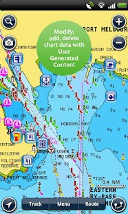
Enjoy the same great detail you have on your GPS chartplotter! Award winning vector maps included in App price remain resident on your device so you can access them when outside internet coverage! Query chart objects anytime for descriptive details. Pan, zoom and measure distance.
ROUTES & TRACKS
Create and edit routes based on your cruising speed and fuel consumption. Record and view your tracks. Capture pictures (geo-tagged) along the way to create a virtual adventure log of your entire trip.
WIND & TIDES
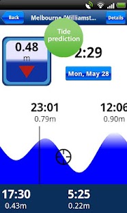
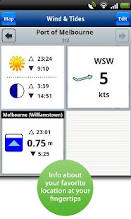
Quickly access up-to-date tide, current, wind speed/direction & sun/moon cycle information. Save your favorite locations. Consult wind forecasts and tide and current predictions while planning trips.
COMMUNITY EDITS
2,000 edits every day! Benefit from timely localized data contributed by the Navionics Community! Wrecks, obstructions, buoys, beacons, lights, and more are visible as soon as posted. Read reviews of marinas, repair shops, etc. Take advantage of this unique feature and be part of the community with your own contributions.
SEARCH
Access the largest database of marine POI’s available. Search by lat/long or category for Marina, Marine Repair, Boat Dealers, Waterfront restaurants, etc!
SHARE
Email, Tweet or FB your routes, tracks, photos or markers! Your friends can learn about your day on the water by viewing the .kmz file you send them in Google Earth! It’s so cool!
MAP OPTIONS
Overlay Google Maps, Bing or Terrain.
SYNC
My Data – automatically sync your Markers, Routes, Tracks and Photos among all your mobile devices.
MAGAZINES & GUIDES
Download free articles from the world’s leading Marine publications! Geo-referenced and saved to a digital library for easy access anytime or anywhere!
COVERAGE
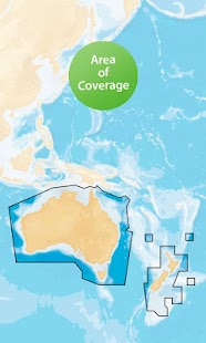
Please refer to screenshot below for chart coverage area contained in this app title.
(308,- Kc)
Pozadavky: Android 2.1 a vyssi
Popis: For boaters, fishermen and water sports enthusiasts of all kinds.
Screen:
What's in this version:
• Facebook login repaired
• Fixed crash retrieving routes from archive
• Fixed crash when saving a Track with a route active on your screen
• Fixed crash retrieving Tide details
Vice info:
Kód: Vybrat vše
https://play.google.com/store/apps/details?id=it.navionics.singleAppOceaniaKód: Vybrat vše
http://uloz.to/x6nNMpEa/marine-australia-newzealand-v2-5-9-4allmobile-eu-apk
https://mega.co.nz/#!DdRQkKJa!KStv_25eOoXkl5shOp7lYxdyqaYrCYaPrdctNUQQ9Ts
http://www38.zippyshare.com/v/45701511/file.htmlEnjoy the same great detail you have on your GPS chartplotter! Award winning vector maps included in App price remain resident on your device so you can access them when outside internet coverage! Query chart objects anytime for descriptive details. Pan, zoom and measure distance.
ROUTES & TRACKS
Create and edit routes based on your cruising speed and fuel consumption. Record and view your tracks. Capture pictures (geo-tagged) along the way to create a virtual adventure log of your entire trip.
WIND & TIDES
Quickly access up-to-date tide, current, wind speed/direction & sun/moon cycle information. Save your favorite locations. Consult wind forecasts and tide and current predictions while planning trips.
COMMUNITY EDITS
2,000 edits every day! Benefit from timely localized data contributed by the Navionics Community! Wrecks, obstructions, buoys, beacons, lights, and more are visible as soon as posted. Read reviews of marinas, repair shops, etc. Take advantage of this unique feature and be part of the community with your own contributions.
SEARCH
Access the largest database of marine POI’s available. Search by lat/long or category for Marina, Marine Repair, Boat Dealers, Waterfront restaurants, etc!
SHARE
Email, Tweet or FB your routes, tracks, photos or markers! Your friends can learn about your day on the water by viewing the .kmz file you send them in Google Earth! It’s so cool!
MAP OPTIONS
Overlay Google Maps, Bing or Terrain.
SYNC
My Data – automatically sync your Markers, Routes, Tracks and Photos among all your mobile devices.
MAGAZINES & GUIDES
Download free articles from the world’s leading Marine publications! Geo-referenced and saved to a digital library for easy access anytime or anywhere!
COVERAGE
Please refer to screenshot below for chart coverage area contained in this app title.