Map Tools - Coordinates Datums
Napsal: 19. 03. 2014 13:54
Map Tools - Coordinates Datums v2.3
(20,- Kc)
Pozadavky: Android 4.0 a vyšší
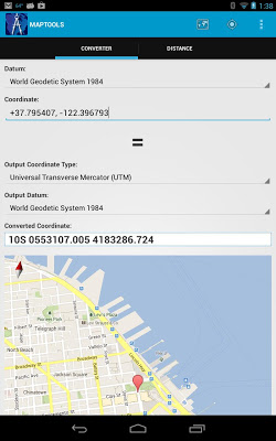
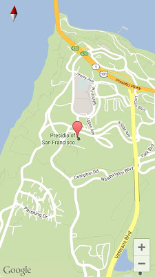
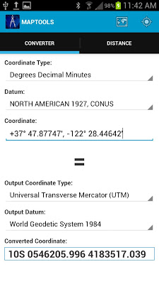
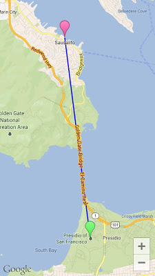
Popis: "Map Tools" is a utility that let users to fully utilize coordinates. Map Tools converts coordinates among various datums and coordinate systems. It also calculates distance and bearing between two coordinates in a number of coordinate systems. You can even get coordinates of your current location in various coordinate systems and datums.
Screen:
What's in this version:
Support US Survey Foot for distance calculation
Make GPS and network optional features
Bugfix
Vice info:
Stahuj zde:
"Map Tools" is a utility that let users to fully utilize coordinates. Map Tools converts coordinates among various datums and coordinate systems. It also calculates distance and bearing between two coordinates in a number of coordinate systems. You can even get coordinates of your current location in various coordinate systems and datums.
GPS and network are not required to use this app.
"Map Tools" Features:
- Coordinates conversion and distance calculation in the following coordinate systems: Geodetic Coordinates (DD, DM, DMS), UTM, UPS, MGRS, USNG, Georef, Map Grid Australia 1994 (MGA94), New Zealand Transverse Mercator 2000 (NZTM2000), New Zealand Map Grid (NZMG) and British National Grid (OSGB).
- Datum conversion. "Map Tools" comes with 230 datums, which include WGS84, NAD27, NAD83, GDA94, NZGD2000, NZGD1949, OSGB36, ED50 and a lot more.
- Use your current location as the input for the coordinate conversion and distance calculation
- Copy and paste the coordinates from and to the app
- Convert between 3 different Geodetic formats: Decimal Degrees, Degrees Minutes, Degrees Minutes Seconds
(20,- Kc)
Pozadavky: Android 4.0 a vyšší
Popis: "Map Tools" is a utility that let users to fully utilize coordinates. Map Tools converts coordinates among various datums and coordinate systems. It also calculates distance and bearing between two coordinates in a number of coordinate systems. You can even get coordinates of your current location in various coordinate systems and datums.
Screen:
What's in this version:
Support US Survey Foot for distance calculation
Make GPS and network optional features
Bugfix
Vice info:
Kód: Vybrat vše
https://play.google.com/store/apps/details?id=com.cleverapplications.android.maptoolsKód: Vybrat vše
http://ul.to/f6pehhvy
http://www.tusfiles.net/j9bnj6o1ox76
http://dfiles.eu/files/fxwjeu5vq
GPS and network are not required to use this app.
"Map Tools" Features:
- Coordinates conversion and distance calculation in the following coordinate systems: Geodetic Coordinates (DD, DM, DMS), UTM, UPS, MGRS, USNG, Georef, Map Grid Australia 1994 (MGA94), New Zealand Transverse Mercator 2000 (NZTM2000), New Zealand Map Grid (NZMG) and British National Grid (OSGB).
- Datum conversion. "Map Tools" comes with 230 datums, which include WGS84, NAD27, NAD83, GDA94, NZGD2000, NZGD1949, OSGB36, ED50 and a lot more.
- Use your current location as the input for the coordinate conversion and distance calculation
- Copy and paste the coordinates from and to the app
- Convert between 3 different Geodetic formats: Decimal Degrees, Degrees Minutes, Degrees Minutes Seconds