Flight Map
Napsal: 25. 03. 2014 19:47
Flight Map v1.2.1
(20,- Kc)
Pozadavky: Android 3.0 a vyšší
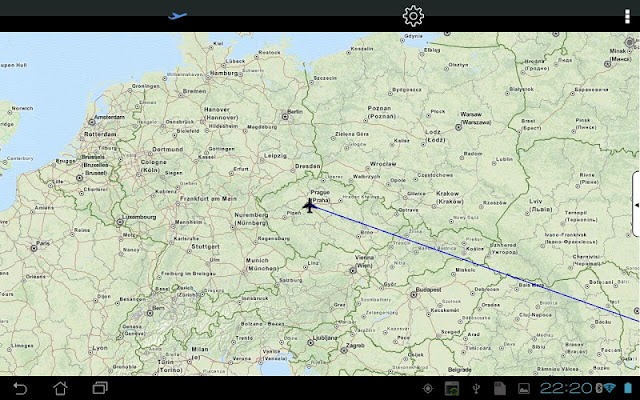
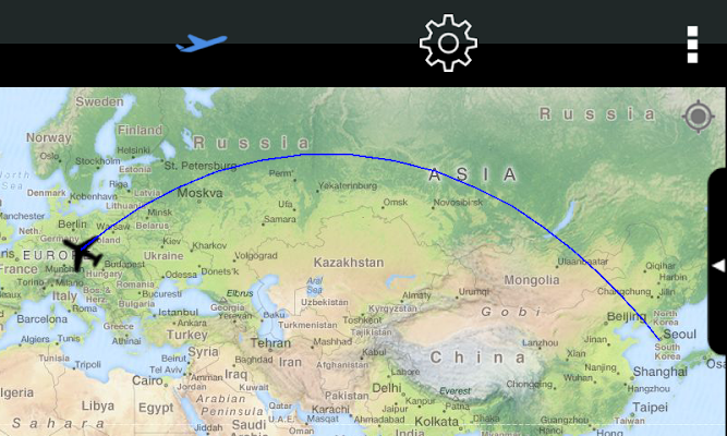
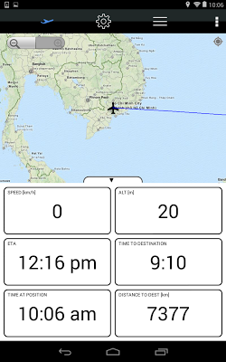
Popis: Flight Map is a unique application that works as your own personal flight tracker (Sky map) while flying in an airplane. It shows where you currently are, speed, altitude and some other information about your flight. You can check the Estimated Time of Arrival of your flight while you are sitting on a plane. You can see how far from the target airport you are. You can also see and name the landmarks on the way, so that you know what you see from your window.
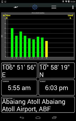
Flight Map also displays visible and used GPS / GLONASS satellites, so you can use it as a GPS testing tool. The GPS function works when your phone is in airplane mode, because it does not broadcast any radio, it rather listens to the GPS satellites only.
Screen:
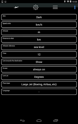
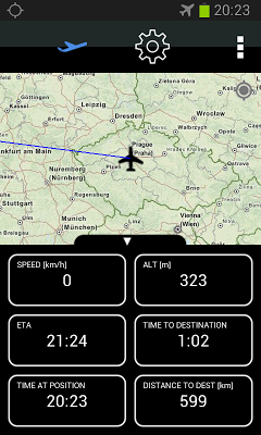
What's in this version:
Version 1.2.1
- Fonts for large and extra large displays (tablets) enlarged.
Version 1.2.0
- Added record route function - route starts to be recorded automatically as soon as speed detected is greater than 180 km/h. Route is identified by a date and destination.
- Recorded route can be shared on social networks (after landing, of course)
Vice info:
Stahuj zde:
Features include:
- Real time position of the plane on the map
- Zoomable world map not dependent on a connection to internet
- Your own personal flight tracker
- Works when your phone is in Airplane mode, so it can be used anytime while in flight
- Recording your route and sharing it on the internet
- Database of world airports
- Estimated Time to Destination and Time to Arrival depending on the plane type and position
- Dark / Light skin
- Metric / Imperial units
- Multilanguage (currently English, Spanish, Portugese, French, Russian, Chinese, Vietnamese, Czech, Japanese, Korean)
- Map can be fullscreen or split screen with real time flight data
- GPS / GLONASS Satellites real time display depending on your device capabilities
- Sunrise and sunset at present position
- Line to destination can be shown or hidden
- Altitude calculation calibrated either to sea level or destination altitude
(20,- Kc)
Pozadavky: Android 3.0 a vyšší
Popis: Flight Map is a unique application that works as your own personal flight tracker (Sky map) while flying in an airplane. It shows where you currently are, speed, altitude and some other information about your flight. You can check the Estimated Time of Arrival of your flight while you are sitting on a plane. You can see how far from the target airport you are. You can also see and name the landmarks on the way, so that you know what you see from your window.
Flight Map also displays visible and used GPS / GLONASS satellites, so you can use it as a GPS testing tool. The GPS function works when your phone is in airplane mode, because it does not broadcast any radio, it rather listens to the GPS satellites only.
Screen:
What's in this version:
Version 1.2.1
- Fonts for large and extra large displays (tablets) enlarged.
Version 1.2.0
- Added record route function - route starts to be recorded automatically as soon as speed detected is greater than 180 km/h. Route is identified by a date and destination.
- Recorded route can be shared on social networks (after landing, of course)
Vice info:
Kód: Vybrat vše
https://play.google.com/store/apps/details?id=marko.android.flightmapKód: Vybrat vše
http://www.tusfiles.net/3vz3lg7jlntf
http://hugefiles.net/ay44doi3lzra
http://unlimitzone.com/pryqgzs5rydk/Flight.Map_v1.2.1.apk.html
http://www66.zippyshare.com/v/40937314/file.html
http://www.tusfiles.net/0z10yc2cqozn
http://uloz.to/xxzcumDH/flight-map-v1-2-1-apk
http://ulozto.sk/xrpUAe4M/flight-map-v1-2-1-apk- Real time position of the plane on the map
- Zoomable world map not dependent on a connection to internet
- Your own personal flight tracker
- Works when your phone is in Airplane mode, so it can be used anytime while in flight
- Recording your route and sharing it on the internet
- Database of world airports
- Estimated Time to Destination and Time to Arrival depending on the plane type and position
- Dark / Light skin
- Metric / Imperial units
- Multilanguage (currently English, Spanish, Portugese, French, Russian, Chinese, Vietnamese, Czech, Japanese, Korean)
- Map can be fullscreen or split screen with real time flight data
- GPS / GLONASS Satellites real time display depending on your device capabilities
- Sunrise and sunset at present position
- Line to destination can be shown or hidden
- Altitude calculation calibrated either to sea level or destination altitude