Airports
Napsal: 12. 12. 2014 21:11
Airports v1.0.0
(138,- Kc)
Pozadavky: Android .0 a vyssi
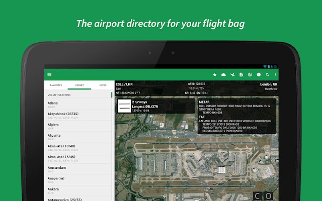
Popis: The airport directory for your flight bag, with a world wide VOLMET station list, NOTAMs, SNOWTAM decoder, METAR and TAF reports, Favorites, Tools, and the ability to save your own notes for those airports you visit frequently.
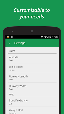
Screen:
What's in this version:
v1.1.3: Airports database update
Vice info:
Stahuj zde:
FEATURES:
- Designed for both tablet and phone. Pay once and use on all your Android devices!
- Airport database containing over 10000 airports world wide.
- Quick search system lets you find airports by city, name, ICAO or IATA code.
- Add your own notes for those airports you visit frequently.
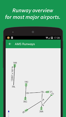
- Runway data (dimensions and surface type) for most major airports.
- Information about types of approaches available for most major airports.
- Favorites section where you can organize your favorite airports in groups.
- Airport data includes time zone, sunrise/sunset times and ATIS frequencies for most major airports.
- Directly call the ATIS telephone line for airports that provide this service.
- Link to online satellite maps for all airports (requires internet connection).
- METAR and TAF reports (requires internet connection). Downloaded weather is saved and kept for 48 hours for offline viewing.
- Runway state groups in METARs are automatically detected and gives you the option to decode them with one tap.
- View NOTAMs for most major airports (requires internet connection). Downloaded SNOWTAMs are detected and can be decoded with one tap.
- Email and print METAR, TAF and NOTAMs.
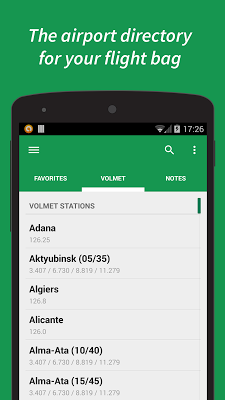
- List of over 180 VOLMET stations world wide, with frequencies and list of airports broadcasted by each station.
- Easily share your notes and favorites.
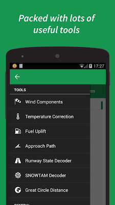
- Tools to calculate wind components, temperature correction, fuel uplift, approach check altitudes and great circle distances. There is also a SNOWTAM decoder and a decoder for runway state groups from METARs.
(138,- Kc)
Pozadavky: Android .0 a vyssi
Popis: The airport directory for your flight bag, with a world wide VOLMET station list, NOTAMs, SNOWTAM decoder, METAR and TAF reports, Favorites, Tools, and the ability to save your own notes for those airports you visit frequently.
Screen:
What's in this version:
v1.1.3: Airports database update
Vice info:
Kód: Vybrat vše
https://play.google.com/store/apps/details?id=info.applicate.airportsappKód: Vybrat vše
https://www.oboom.com/I2A2E49Q/Airports.v.1.0.0.b.21.crk.LVL.Auto.Removed.apk
http://turbobit.net/4w616oxib0ql.html
http://ul.to/41t78nqd
http://www.tusfiles.net/5enlb88v0kpe
http://uloz.to/xyMA8Wpc/airports-v1-0-0-apk
https://webshare.cz/file/5821n7s7fC/airports-v1-0-0-apk
- Designed for both tablet and phone. Pay once and use on all your Android devices!
- Airport database containing over 10000 airports world wide.
- Quick search system lets you find airports by city, name, ICAO or IATA code.
- Add your own notes for those airports you visit frequently.
- Runway data (dimensions and surface type) for most major airports.
- Information about types of approaches available for most major airports.
- Favorites section where you can organize your favorite airports in groups.
- Airport data includes time zone, sunrise/sunset times and ATIS frequencies for most major airports.
- Directly call the ATIS telephone line for airports that provide this service.
- Link to online satellite maps for all airports (requires internet connection).
- METAR and TAF reports (requires internet connection). Downloaded weather is saved and kept for 48 hours for offline viewing.
- Runway state groups in METARs are automatically detected and gives you the option to decode them with one tap.
- View NOTAMs for most major airports (requires internet connection). Downloaded SNOWTAMs are detected and can be decoded with one tap.
- Email and print METAR, TAF and NOTAMs.
- List of over 180 VOLMET stations world wide, with frequencies and list of airports broadcasted by each station.
- Easily share your notes and favorites.
- Tools to calculate wind components, temperature correction, fuel uplift, approach check altitudes and great circle distances. There is also a SNOWTAM decoder and a decoder for runway state groups from METARs.
