


412,-Kč
Požadavky: Android: 2.2.3 a vyšší + Lucky Patcher & Mod GP
Popis:
The leading tool for the professional surveyor offering the best accuracy and extensive functionality that no other app can!
Screen:
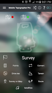
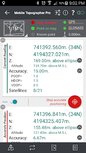
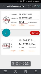
Vice info:
Kód: Vybrat vše
https://play.google.com/store/apps/details?id=gr.stgrdev.mobiletopographerproKód: Vybrat vše
https://dailyuploads.net/pjb1mnxyq0ug
https://dropapk.com/lq85x0d2noa1
https://userscloud.com/3o4qjdndrzre
https://webshare.cz/file/55m1m54Qx4/mobile-topographer-pro-11-0-0-apk*** Export data in the standard of GIS Shape files (.shp)
*** Import file
- Import points from file in WGS84 format or CRS of your choice.
- Import points from text files (.txt, .csv) or Shape files (.shp)
*** 3D Terrain modeling & contours
- Collect terrain data.
- Create a 3D terrain model.
- Create contours.
- Show on map.
- Load, save, export 3D terrain model and contours.
*** Route tracking
- Track your route.
- Process route
- Get statistics.
- Show on map.
- Load, save, export route.
*** Real time map projection while surveying
*** Survey on map.
- Complete a survey without even going to the field.
- Insert, modify or delete points directly on the map.
- Correct or make additions to an existing survey.
*** Group points
- Divide your list of points in groups.
- Filter list of points view, by naming groups.
- Export list of points with group division or filtering.
- Select the contents of the exported lists of points.
*** Device Elevation
*** Auto survey mode
*** Area, Perimeter, Number of vertices of polygon
*** Manually edit coordinates of a point.
- Key in the new coordinates of a point.
- Reposition a point on the map using drag & drop or edit mode.
*** Swipe from left to view satellites while surveying.
*** View GNSS satellites in Augmented Reality.
*** Full functionality even without internet connection.
*** Maps v2.
*** Weather.
*** Increased accuracy.
Plus the well known features of Mobile Topographer Free:
*** Increase GPS accuracy using:
- Weighted averaging (on every axis).
- Map calibration.
- Device calibration on map, or on a know point.
*** Display and convert GPS geodetic to cartesian EN coordinates and back:
- UTM.
- Europe ETRS89/UTMZ28-38.
- Hellas HGRS 87 (GGRS87 - EGSA 87 - ΕΓΣΑ 87).
- Hellas HGRS 87 (HEPOS).
- Hellas HTRS07/TM07.
- Morocco Merchich CS.
- SPCS83 (124 zones) USA.
- Brazil & Central and South America SIRGAS 2000.
- Brazil SAD69/UTM Z18-25 & SAD69(96)/UTM Z18-25.
- Australia MGA94 (GDA94) & AMG66 (AGD66) National, A.C.T., Northern Territory, NSW & Victoria, Tasmania & AMG84 (AGD84).
- Italy Monte Mario West Zone 1 Peninsular, West Zone 1 Sardinia, East Zone 2 Peninsular, East Zone 2 Sicily.
- Spain ED50/UTMZ29-30 NW, ED50/UTMZ29-31 ML, ED50/UTMZ31 BA.
- Uk's OSTN02/OSGM02.
- Turkey ED
50/Gauss-Kruger 3° Z9-15 & ITRF96 & ED50/UTMZ35-38.
- Argentina POSGAR 94 & POSGAR 2007.
- India Kalianpur 1975 ZI - ZIV.
- Central and South American SIRGAS 2000.
- France RGF93/CC42-50 Auto & manual.
- Canada CSRS (19 systems).
- Carthage of Tunisia.


